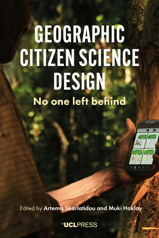
Geographic Citizen Science Design
No one left behind
Artemis Skarlatidou (Editor), Muki Haklay (Editor)
Little did Isaac Newton, Charles Darwin and other ‘gentlemen scientists’ know, when they were making their scientific discoveries, that some centuries later they would inspire a new field of scientific practice and innovation, called citizen science. The current growth and availability of citizen science projects and relevant applications to support citizen involvement is massive; every citizen has an opportunity to become a scientist and contribute to a scientific discipline, without having any professional qualifications. With geographic interfaces being the common approach to support collection, analysis and dissemination of data contributed by participants, ‘geographic citizen science’ is being approached from different angles.
Geographic Citizen Science Design takes an anthropological and Human-Computer Interaction (HCI) stance to provide the theoretical and methodological foundations to support the design, development and evaluation of citizen science projects and their user-friendly applications. Through a careful selection of case studies in the urban and non-urban contexts of the Global North and South, the chapters provide insights into the design and interaction barriers, as well as on the lessons learned from the engagement of a diverse set of participants; for example, literate and non-literate people with a range of technical skills, and with different cultural backgrounds.
Looking at the field through the lenses of specific case studies, the book captures the current state of the art in research and development of geographic citizen science and provides critical insight to inform technological innovation and future research in this area.
Praise for Geographic Citizen Science Design
‘The “Indigenous Communities” chapters focus on representation of traditional ecological knowledge in Canada, Central Africa, and Brazilian Amazonia. This section provides exceptional insight into the design challenges of representing, e.g., pictographs or nonstandard characters using standard XML data architecture in user interface design, citing the Sapelli cellphone app developed to overcome language and literacy barriers This open-access text is commended to interdisciplinary readers interested in the confluence of user interface design, mobile geographic information systems, cultural anthropology, international development, and digital government … Essential [for] Upper-division undergraduates. Graduate students, faculty, and professionals. General readers.’
Choice
‘This is a fascinating book describing a shift in scientific paradigms to accommodate projects which are contextualised by place and needs of local communities and their cultures, using the most innovative and user-friendly technologies and where the outcomes can be radical and empowering for those participating.’
Geographical Education
List of figures
List of tables
List of contributors
Foreword
Jenny Preece
Acknowledgements
Introduction
Geographic citizen science design: no one left behind
Artemis Skarlatidou and Muki Haklay
Part I: Theoretical and methodological principles
1 Geographic citizen science: an overview
Muki Haklay
2 Design and development of geographic citizen science: technological perspectives and considerations
Vyron Antoniou and Chryssy Potsiou
3 Design approaches and human–computer interaction methods to support user involvement in citizen science
Artemis Skarlatidou and Carol Iglesias
4 Methods in anthropology to support the design and implementation of geographic citizen science
Raffaella Fryer-Moreira and Jerome Lewis
Part II: Interacting with geographic citizen science in the Global North
5 Geographic expertise and citizen science: planning and co-design implications
Robert Feick and Colin Robertson
6 Citizen science mobile apps for soundscape research and public space studies: lessons from the Hush City project
Antonella Radicchi
7 Using mixed methods to enhance user experience: developing Global Forest Watch
Jamie Gibson
8 Path of least resistance: using geo-games and crowdsourced data to map cycling frictions
Diego Pajarito, Suzanne Maas, Maria Attard and Michael Gould
9 Geographic citizen science in citizen–government communication and collaboration: lessons learned from the ImproveMyCity application
Ioannis Tsampoulatidis, Spiros Nikolopoulos, Ioannis Kompatsiaris and Nicos Komninos
Part III: Geographic citizen science with indigenous communities
10 Developing a referrals management tool with First Nations in Northern Canada: an iterative programming approach
Jon Corbett and Aaron Derrickson
11 Lessons from recording Traditional Ecological Knowledge in the Congo Basin
Michalis Vitos
12 Co-designing extreme citizen science projects in Cameroon: biodiversity conservation led by local values and indigenous knowledge
Simon Hoyte
13 Community monitoring of illegal logging and forest resources using smartphones and the Prey Lang application in Cambodia
Ida Theilade, Søren Brofeldt, Turreira-García and Dimitrios Argyriou
14 Representing a fish for fishers: geographic citizen science in the Pantanal wetland, Brazil
Rafael Chiaravalloti
15 Digital technology in the jungle: a case study from the Brazilian Amazon
Carolina Comandulli
16 Community mapping as a means and an end: how mapping helped Peruvian students explore gender equality
Peter Ward and Rebecca Firth
Synthesis and Epilogue Geographic citizen science design: No one left behind – an overview and synthesis of methodological, technological and interaction design recommendations
Artemis Skarlatidou and Muki Haklay
Index
DOI: 10.14324/111.9781787356122
Number of illustrations: 64
Publication date: 04 February 2021
PDF ISBN: 9781787356122
EPUB ISBN: 9781787356153
Hardback ISBN: 9781787356146
Paperback ISBN: 9781787356139
Artemis Skarlatidou (Editor) 
Artemis Skarlatidou is Senior Research Associate in the Extreme Citizen Science (ExCiteS) group at UCL. Her research interests include Risk Communication, Human-Computer Interaction (HCI) and User Experience aspects (e.g. usability, aesthetics, trust) of citizen science applications, geospatial technologies and their spatial representations for expert and public use.
Muki Haklay (Editor) 
Muki Haklay is Professor of Geographic Information Science at UCL. His research interests include public access, use, and creation of environmental information; interaction with geographical technologies; participatory mapping; and citizen science. He is the co-director of UCL Extreme Citizen Science group (ExCiteS) and co-founder of the social enterprise Mapping for Change.
‘The “Indigenous Communities” chapters focus on representation of traditional ecological knowledge in Canada, Central Africa, and Brazilian Amazonia. This section provides exceptional insight into the design challenges of representing, e.g., pictographs or nonstandard characters using standard XML data architecture in user interface design, citing the Sapelli cellphone app developed to overcome language and literacy barriers This open-access text is commended to interdisciplinary readers interested in the confluence of user interface design, mobile geographic information systems, cultural anthropology, international development, and digital government … Essential [for] Upper-division undergraduates. Graduate students, faculty, and professionals. General readers.’
Choice
‘This is a fascinating book describing a shift in scientific paradigms to accommodate projects which are contextualised by place and needs of local communities and their cultures, using the most innovative and user-friendly technologies and where the outcomes can be radical and empowering for those participating.’ Geographical Education
Related titles
Citizen Science
Susanne Hecker, Muki Haklay, Anne Bowser, Zen Makuch, Johannes Vogel, Aletta Bonn, Carlos Moedas, Commisioner (2015-19) Research, Science and Innovation, European Commission,
15 October 2018
Geographic Citizen Science Design
No one left behind
Little did Isaac Newton, Charles Darwin and other ‘gentlemen scientists’ know, when they were making their scientific discoveries, that some centuries later they would inspire a new field of scientific practice and innovation, called citizen science. The current growth and availability of citizen science projects and relevant applications to support citizen involvement is massive; every citizen has an opportunity to become a scientist and contribute to a scientific discipline, without having any professional qualifications. With geographic interfaces being the common approach to support collection, analysis and dissemination of data contributed by participants, ‘geographic citizen science’ is being approached from different angles.
Geographic Citizen Science Design takes an anthropological and Human-Computer Interaction (HCI) stance to provide the theoretical and methodological foundations to support the design, development and evaluation of citizen science projects and their user-friendly applications. Through a careful selection of case studies in the urban and non-urban contexts of the Global North and South, the chapters provide insights into the design and interaction barriers, as well as on the lessons learned from the engagement of a diverse set of participants; for example, literate and non-literate people with a range of technical skills, and with different cultural backgrounds.
Looking at the field through the lenses of specific case studies, the book captures the current state of the art in research and development of geographic citizen science and provides critical insight to inform technological innovation and future research in this area.
Praise for Geographic Citizen Science Design
‘The “Indigenous Communities” chapters focus on representation of traditional ecological knowledge in Canada, Central Africa, and Brazilian Amazonia. This section provides exceptional insight into the design challenges of representing, e.g., pictographs or nonstandard characters using standard XML data architecture in user interface design, citing the Sapelli cellphone app developed to overcome language and literacy barriers This open-access text is commended to interdisciplinary readers interested in the confluence of user interface design, mobile geographic information systems, cultural anthropology, international development, and digital government … Essential [for] Upper-division undergraduates. Graduate students, faculty, and professionals. General readers.’
Choice
‘This is a fascinating book describing a shift in scientific paradigms to accommodate projects which are contextualised by place and needs of local communities and their cultures, using the most innovative and user-friendly technologies and where the outcomes can be radical and empowering for those participating.’
Geographical Education
‘The “Indigenous Communities” chapters focus on representation of traditional ecological knowledge in Canada, Central Africa, and Brazilian Amazonia. This section provides exceptional insight into the design challenges of representing, e.g., pictographs or nonstandard characters using standard XML data architecture in user interface design, citing the Sapelli cellphone app developed to overcome language and literacy barriers This open-access text is commended to interdisciplinary readers interested in the confluence of user interface design, mobile geographic information systems, cultural anthropology, international development, and digital government … Essential [for] Upper-division undergraduates. Graduate students, faculty, and professionals. General readers.’
Choice
‘This is a fascinating book describing a shift in scientific paradigms to accommodate projects which are contextualised by place and needs of local communities and their cultures, using the most innovative and user-friendly technologies and where the outcomes can be radical and empowering for those participating.’ Geographical Education

